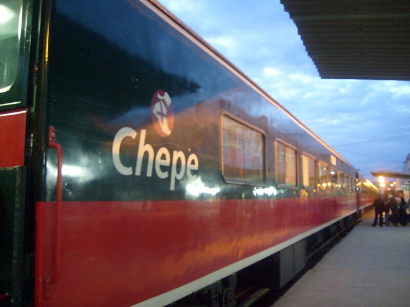
The Ferrocarril Chihuahua al Pacífico, also known as El Chepe from its reporting mark CHP, is a major rail line in northwest Mexico, linking Chihuahua City to Los Mochis and its port, Topolobampo. It crosses the Sierra Madre Occidental, part of the range that in the United States is called the Rocky Mountains. There is no road covering the trajectory.
It runs 673 km, traversing the Copper Canyon, a rugged series of canyons that have led some to call this the most scenic railroad trip on the continent. It is both an important transportation system for locals and a draw for tourists.The tracks pass over 37 bridges and through 86 tunnels, rising as high as 2,400 m above sea level near Divisadero, a popular lookout spot over the canyons. Each one-way trip takes roughly 16 hours. The track also crosses over itself to gain elevation.
Wikipedia https://en.wikipedia.org/wiki/Ferrocarril_Chihuahua_al_Pacífico
Official website http://www.chepe.com.mx/
Facebook https://www.facebook.com/ChepeOficial
Email chepe@ferromex.com.mx
Phone +52 614 439 7211
Address 2205 Calle Juan José Méndez, Chihuahua 31030, Mexico
Coordinates 28°37'19.852" N -106°4'15.157" E