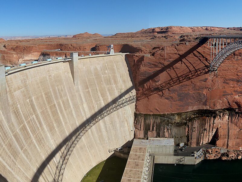
The Glen Canyon Bridge or Glen Canyon Dam Bridge is a steel arch bridge in Coconino County, Arizona, carrying U.S. Route 89 across the Colorado River. The bridge was originally built by the United States Bureau of Reclamation to facilitate transportation of materials for the Glen Canyon Dam, which lies adjacent to the bridge just 865 feet upstream. The two-lane bridge has an overall length of 1,271 feet with a deck 700 feet above the river, making it the one of the highest bridges in the United States. The bridge was the highest arch bridge in the world when completed in 1959.
Download Download See moreWikipedia https://en.wikipedia.org/wiki/Glen_Canyon_Dam_Bridge
Address US Highway 89, 86040, United States
Coordinates 36°56'8.193" N -111°28'58.533" E