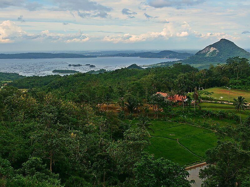
The Jatiluhur Dam is a multi-purpose embankment dam on the Citarum River in West Java, Indonesia. It is located 70 km east of Jakarta, close to the medium-size town of Purwakarta.
Jatiluhur Dam was designed by Coyne et Bellier and was constructed between 1957 and 1965 while the power station become operational in 1967. The dam serves several purposes including the provision of hydroelectric power generation, water supply, flood control, irrigation and aquaculture. The power station has an installed capacity of 186.5 MW which feeds into the Java grid managed by the state-owned electricity company Perusahaan Listrik Negara. The Jatiluhur reservoir helps irrigate 240,000 ha of rice fields. The earth-fill dam is 105 m high and withholds a reservoir of 3,000,000,000 m3, the largest in the country.
Wikipedia https://sv.wikipedia.org/wiki/Bendungan_Ir._H._Juanda
Address Jalan Bendungan Utama Jatiluhur, 41152, Indonesia
Coordinates -6°31'22.325" N 107°23'20.558" E