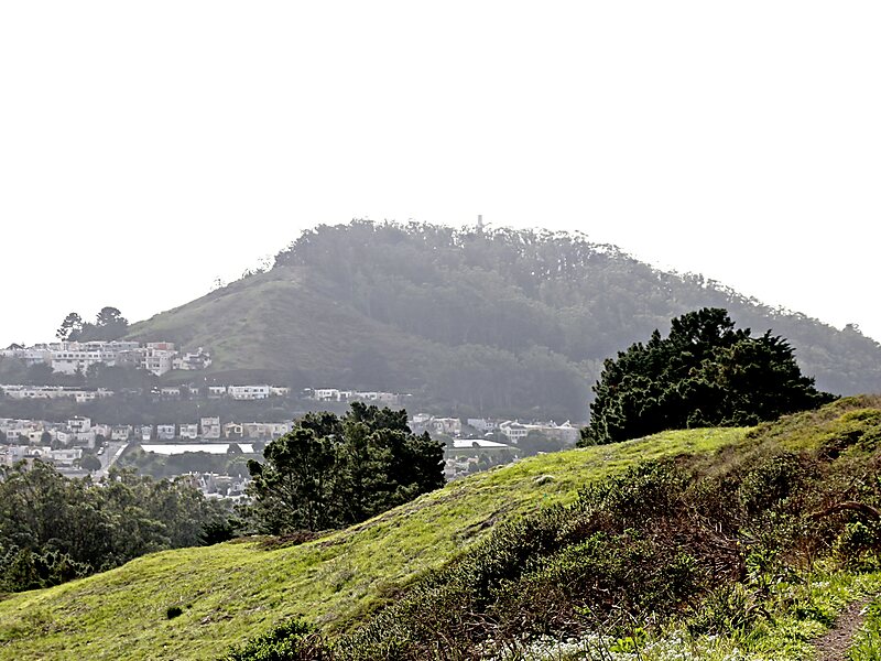
Mount Davidson is the highest natural point in San Francisco, California, with an elevation of 928 feet. It is located near the geographical center of the city, south of Twin Peaks and Portola Drive and to the west of Diamond Heights and Glen Park. It dominates the southeastern view from most of Portola Drive. It is one of San Francisco's many hills and one of its original "Seven Hills".Mount Davidson's most notable feature, aside from its height, is the 103-foot concrete cross situated on the crest of the hill. It is the site of a yearly prayer service, performed on Easter, when the cross is illuminated, and a yearly commemoration of the Armenian genocide, held on April 24.Mount Davidson Park tops the hill – excluding the land at the summit, which is privately owned. The parkland portion is located between Myra Way, Dalewood Way, and Juanita Way. Public transportation is provided by the 36 Teresita Muni line, which stops at the Dalewood Way and Myra Way entrance to the park.
Download Download See morePark is open daily from 6 am to 10 pm.
Admission to the park is free.
Wikipedia https://en.wikipedia.org/wiki/Mount_Davidson_(California)
Official website http://mtdavidson.org/
More information http://sfrecpark.org/destination/mt-davidson-park/
Address 427 Myra Way San Francisco, CA 94127, USA
Coordinates 37°44'17.751" N -122°27'11.897" E