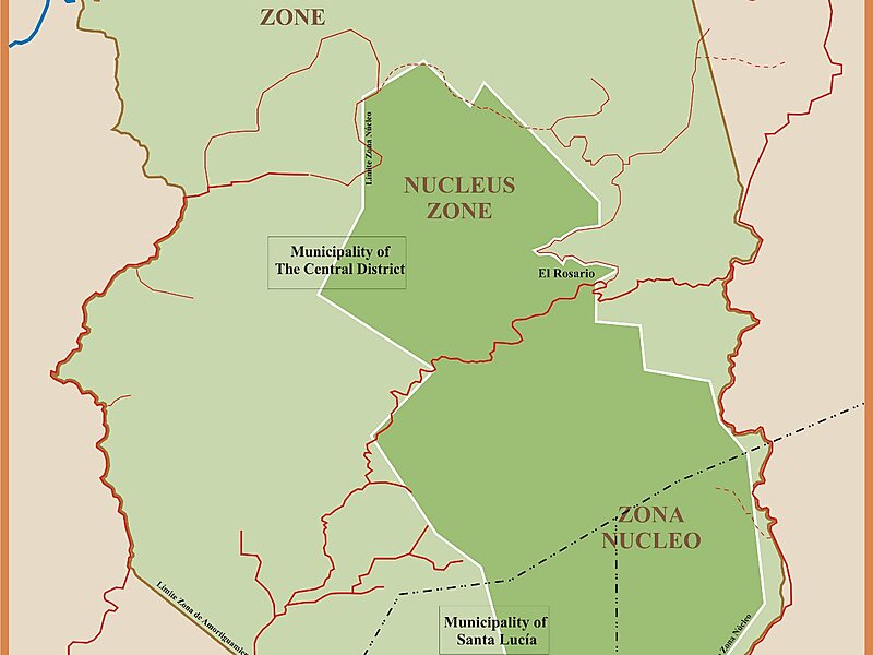
La Tigra National Park was the first national park in Honduras, by decree No. 976-80 whose principal objective is "The Conservation, Ecologic Preservation and Maintenance of The Hydrologic Potential of this Reserve". It was established on 1 January 1980 and covers an area of 238 square kilometers. It has an altitude of between 1,800 and 2,185 metres.In addition to its natural environment and history, the La Tigra Mountain with its cloud forest tropical vegetation also provides more than 30% of the necessities of the capital city, Tegucigalpa, and 100% of the bordering communities and has been protected since the early 1920s, evidence of this are the weirs of Jutiapa. It is a cloud forest with an area of 328 km2, located 25 km from Tegucigalpa.
The park is located 25 km north of Tegucigalpa. It has four access points, but for visiting purposes 2 routes are mainly used: the highway leading to El Hatillo and the highway leading to Valle de Ángeles, San Juancito and Cantarranas.
Wikipedia https://en.wikipedia.org/wiki/La_Tigra_National_Park
Address Honduras
Coordinates 14°13'18.44" N -87°6'57.92" E