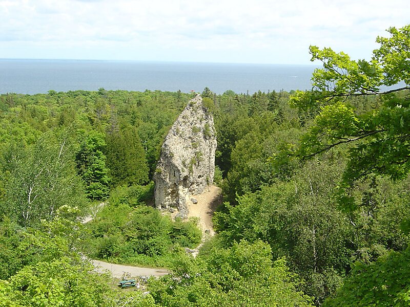
Sugar Loaf is a 75-foot-high landlocked rock or stack in the interior of Mackinac Island in Lake Huron. Created by erosion during the period of postglacial Lake Algonquin, Sugar Loaf is the largest post-glacial erosion feature in the Straits of Mackinac.
The immense rock, which consists of resistant limestone breccia, was cut off from Ancient Mackinac Island or the Turtle's Back by the glacial meltwaters of Lake Algonquin. Polar storms released by the retreating ice sheet created erosional forces much stronger than any existing today on the Great Lakes.
Wikipedia https://en.wikipedia.org/wiki/Sugar_Loaf_(Mackinac_Island)
Address Sugar Loaf Rd, 49757, United States
Coordinates 45°51'41.926" N -84°37'1.875" E