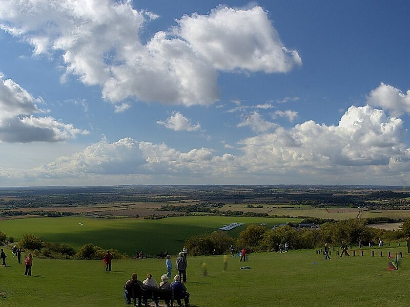
Dunstable Downs are part of the Chiltern Hills, in southern Bedfordshire in England. They are a chalk escarpment forming the north-eastern reaches of the Chilterns. At 797 ft, Dunstable Downs are the highest point of the county of Bedfordshire.Because of its elevation, Dunstable Downs hosted a station in the shutter telegraph chain which connected the Admiralty in London to its naval ships in the port of Great Yarmouth during the years 1808 to 1814.Whipsnade Zoo has cut an enormous lion shape into the chalk into the side of one of the hills. The lion can be seen from the B489.
The downs are used by gliders, kite fliers, hang gliders and paragliders in the area because of their height. The London Gliding Club is based at the foot of the downs.
Wikipedia https://en.wikipedia.org/wiki/Dunstable_Downs
Official Website http://www.nationaltrust.org.uk/dunstable-downs-chilterns-gateway-and-whipsnade-estate/
Coordinates 51°51'59.238" N -0°32'32.095" E