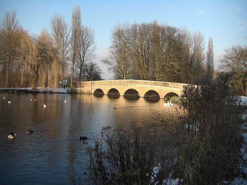
Foots Cray Meadows is an area of parkland and woodland 97 hectares in size, within the London Borough of Bexley, England. It borders the suburbs of Albany Park, Sidcup, Foots Cray, North Cray and Ruxley. The River Cray runs through it in a north-easterly direction. The London Loop, a public recreational walking path around London, also known as the "M25 for walkers", runs through the meadows parallel to the river from Sidcup Place, just south of the meadows. Two notable bridges cross the River Cray in the meadows: Five Arches bridge and the smaller Penny Farthing Bridge.
The Meadows are a Local Nature Reserve and a Site of Metropolitan Importance for Nature Conservation. They have also received a Green Flag Award. There is access from Rectory Lane, among other places. Adjacent to the meadows is what was the kitchen garden and stables of the Foots Cray Place estate and which included a boules alley with a summer house which is still standing.
Wikipedia https://en.wikipedia.org/wiki/Foots_Cray_Meadows
Address (Unnamed Road), Bexley DA14 4, United Kingdom
Coordinates 51°25'33.083" N 0°7'38.194" E