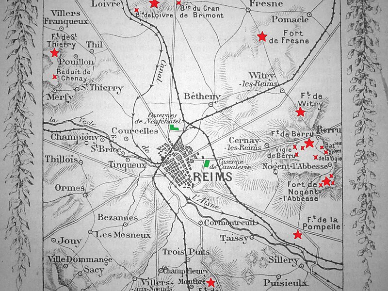
The Fort de la Pompelle, also known as Fort Herbillon, is one of a number of forts built around Reims after 1870 as part of a fortification belt in the Séré de Rivières system. The forts saw combat during the First World War in the defense of Reims. The fort is located about 2 kilometres north of the town of Sillery, next to the N44 road, between Reims and Châlons-en-Champagne. Constructed as a supporting position for larger forts and disarmed in 1913, it saw the heaviest fighting of the Reims forts. It was bombarded during the war and remains in a state of ruin.
Download Download See moreWikipedia https://en.wikipedia.org/wiki/Fort_de_la_Pompelle
Coordinates 49°12'58.491" N 4°7'45.28" E