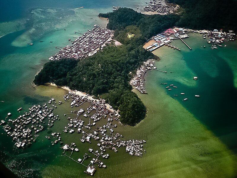
Gaya Island is a sizeable Malaysian island of 1,465 ha, just 10 minutes off Kota Kinabalu, Sabah and forms part of the Tunku Abdul Rahman National Park. Gaya Island derived its name from the Bajau word "Gayo" which means big and occupies an area of 15 km2 with an elevation of up to 300 metres. Several ridges rise more than 600 feet, peaking at 1,000 feet, along the backbone of Gaya Island.
Gaya is the largest island in the Tunku Abdul Rahman National Park, closest to downtown Kota Kinabalu and is covered with dense virgin, tropical forest. It has been a forest reserve since 1923. The island has 20 km of hiking trails and three 5 star resorts named Gayana Marine Resort, home to the Marine Ecology Research Centre, the neighboring Gaya Island Resort, the Bunga Raya Island Resort on the north-east part of the island. Historically, Gaya Island was also the site of the English colonialist's British North Borneo Company's harbour, razed by the folk hero Mat Salleh on 9 July 1897.
Wikipedia https://en.wikipedia.org/wiki/Gaya_Island
Coordinates 6°1'3.151" N 116°1'53.873" E