The Pag Bridge is the bridge that connects the island of Pag to the Croatian mainland. It is a 301 meters long, 9 meters wide bridge whose 201 meters long arch rises 35 meters above an Adriatic Sea strait called Ljubačka Vrata. It was opened on 17 November 1968, and it transformed life on the island of Pag to be able to function more as a peninsula.The bridge was built by the local company Mostogradnja, designed by civil engineer Ilija Stojadinović, who also designed the nearby Šibenik Bridge. The location of the bridge near Velebit causes the bridge to endure strong gusts of wind, the bora, and during the construction the wind speed was 8 on the Beaufort scale for a period of four months. In a 2019 spring storm, the top wind speed on the bridge was 198 kilometres per hour.
Download Download See more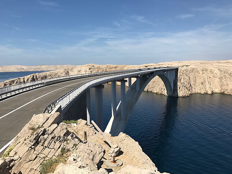
Wikipedia https://en.wikipedia.org/wiki/Pag_Bridge
Coordinates 44°19'29.338" N 15°15'30.048" E

