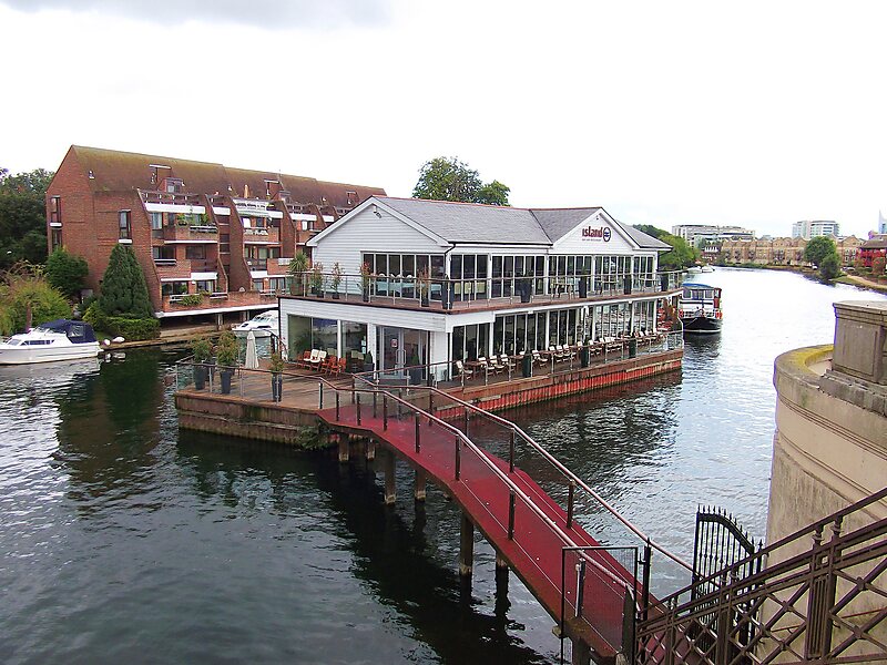
Pipers Island, or Piper's Island, is the third-smallest map-named island in the River Thames, in England. It is on the Reading, Berkshire reach. It is toward the edge of the central urban area of the town of Reading and connected by a gangway to Caversham Bridge, a road and pedestrian bridge that links that town to its left bank suburb of Caversham.
Download Download See moreWikipedia https://en.wikipedia.org/wiki/Pipers_Island
Coordinates 51°27'56.386" N -0°58'35.011" E