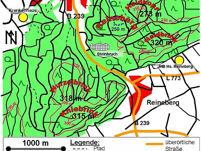
The Reineberg is a hill on the Wiehen ridge, south of the town of Lübbecke. With a height of 275.9 m above sea level it is, from a topographical point of view, not a particularly impressive eminence in this part of the Wiehen Hills, because, in the immediate vicinity are considerably higher summits, such as the 320 m high Heidbrink just under 1 km to the south. East of the Reinberg on the other side of a valley bottom rises the Heidkopf, west of the Meesenkopf, on the summit of which there was once a fortification. 230 metres southwest of the summit lies the Wittekind Spring, that had a certain importance for the garrison of the castle at the summit, but today is just a small pond by a rock outcrop at the edge of a track.
The Reineberg, which is the local hill for the town of Lübbecke, owes its significance to the fact that, until 1723, the year of its demolition, Reineberg Castle stood here.
Wikipedia https://en.wikipedia.org/wiki/Reineberg
Address 32312, Germany
Coordinates 52°17'38.204" N 8°37'46.713" E