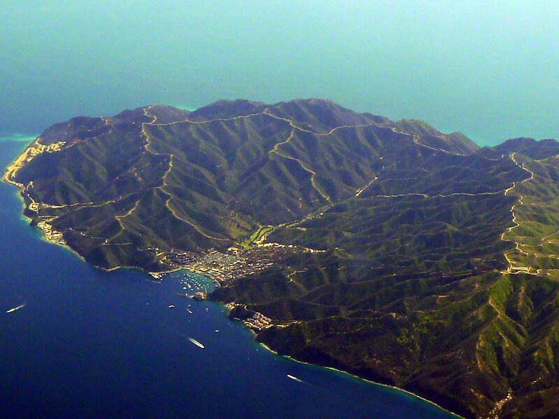
Santa Catalina Island is a rocky island off the coast of Southern California in the Gulf of Santa Catalina. The island name is often shortened to Catalina Island or just Catalina. The island is 22 mi long and 8 mi across at its greatest width. The island is located about 29 mi south-southwest of Long Beach, California. The highest point on the island is Mount Orizaba. Geologically, Santa Catalina is part of the Channel Islands of California archipelago and lies within Los Angeles County. Catalina Island is the easternmost of the Channel Islands. Politically, Catalina Island is part of Los Angeles County in District 4. Most of the land on the island is unincorporated with 90% of the population living in the city of Avalon.
Catalina was originally inhabited and used by many different Southern California Tribes, including the Tongva, who called the island Pimuu'nga or Pimu and referred to themselves as Pimugnans or Pimuvit.
Wikipedia https://en.wikipedia.org/wiki/Santa_Catalina_Island_(California)
Coordinates 33°22'55.423" N -118°25'59.649" E