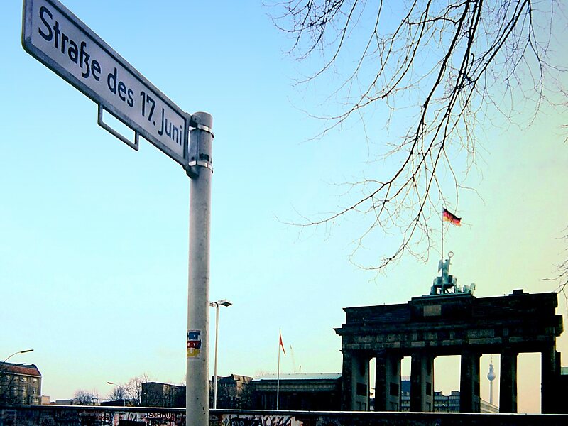
The Straße des 17. Juni, is a street in central Berlin, the capital of Germany. Its name refers to the 17 June 1953 uprising in East Germany. It is the western continuation of the boulevard Unter den Linden. It runs east–west through the Tiergarten, a large park to the west of the city centre. At the eastern end of the street is the Brandenburg Gate and the Platz des 18. März, it then passes the Soviet War Memorial before passing either side of Victory Column in the middle of the park, and out of the park through the Charlottenburg Gate, terminating about half a kilometre later at Ernst-Reuter-Platz. The street is a section of the main western thoroughfare radiating out from the centre of Berlin so the road continues to the west of Ernst-Reuter-Platz, the first section of which is called Bismarckstraße.
Download Download See moreWikipedia https://en.wikipedia.org/wiki/Straße_des_17._Juni
Address 100 Straße des 17. Juni, Berlin 10557, Germany
Coordinates 52°30'49.027" N 13°20'10.172" E