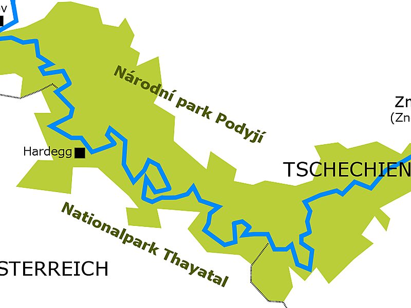
Thayatal National Park is a 13.3 km2 Austrian national park located in the Lower Austrian border area with the Czech Republic. It connects to the Czech Podyjí National Park. The Thayatal with its steep hillside forests is one of the most beautiful breakthrough valleys in Austria. The highest point is the gneiss mountain around which the Thaya flows.
The basis for the national park is the Lower Austrian National Park Act. It was agreed between the republic and the federal state back in 1997. It is largely based on the international criteria for national parks published by the IUCN, the International Union for Conservation of Nature. The Thayatal is referred to as a Category II area. When it was founded, it was planned to enlarge it to 1.7 km2.250 ha of the core zone of the national park belong to the WILDForest areas certified by the European Wilderness Society, 2 km of the Thaya is also certified as a WILDRiver.
Wikipedia https://en.wikipedia.org/wiki/Thayatal_National_Park
Email office@np-thayatal.at
Phone +43 2949 7005 0
Address 2081, Austria
Coordinates 48°49'31.635" N 15°53'45.666" E