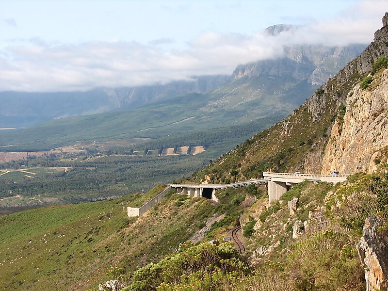
Sir Lowry's Pass is a mountain pass on the N2 national road in the Western Cape province of South Africa. It crosses the Hottentots Holland Mountains between Somerset West and the Elgin valley, on the main route between Cape Town and the Garden Route. A railway line also crosses the mountain range near this point.
The pass is 4 lanes wide and is subject to heavy traffic, especially at the start and end of holiday periods when many people travel in and out of the Cape Town area, and is sometimes seen as an accident black spot.The summit of the pass is at 460 m. There is a viewpoint at this point which is also used as a paragliding launch point. Baboons are often seen in this area. The top of the pass was formerly the start of the Boland Hiking Trail, but this section of the trail was closed after a number of deaths due to the difficult hiking conditions. On the Grabouw side, the road passes the Steenbras Dam.
Wikipedia https://en.wikipedia.org/wiki/Sir_Lowry's_Pass
Official Website http://www.capemountainpasses.co.za/
Address (Unnamed Road), South Africa
Coordinates -34°8'56.616" N 18°55'39.545" E