
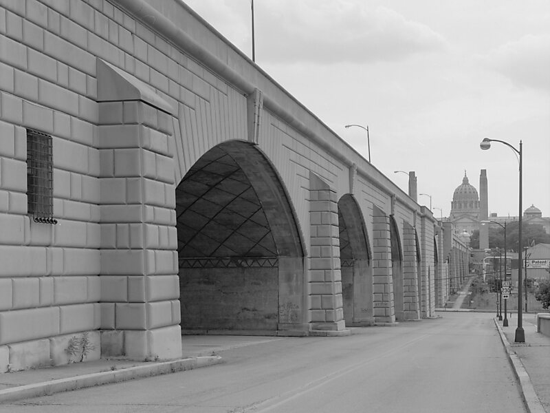
The State Street Bridge, also known as the Soldiers and Sailors Memorial Bridge, is a 1,312-foot concrete, deck arch bridge that spans Pennsylvania Route 230 and Paxton Creek in Harrisburg, Pennsylvania. The bridge was completed in 1930 and was intended to be the principal entrance into downtown Harrisburg and the Pennsylvania State Capitol Complex from the east.
The bridge was listed on the National Register of Historic Places on June 22, 1988, and was documented by the Historic American Engineering Record in 1997.
Wikipedia https://en.wikipedia.org/wiki/State_Street_Bridge_(Harrisburg,_Pennsylvania)
Address 186 N 10th St, Harrisburg 17101, United States
Coordinates 40°16'2.071" N -76°52'36.117" E
