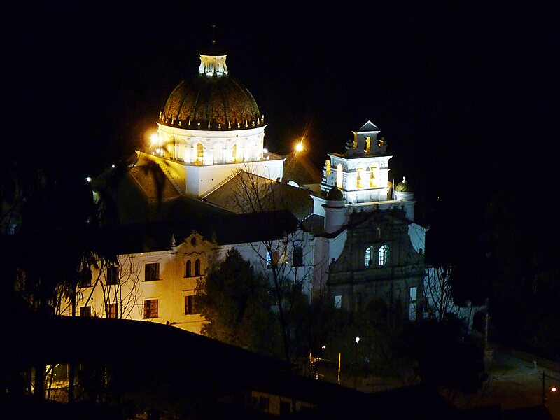
Guápulo is a district of Quito, Ecuador, also called an electoral parish. The parish was established as a result of the October 2004 political elections when the city was divided into 19 urban electoral parishes. Set behind Hotel Quito, the neighborhood of Guápulo runs down the winding Camino de Orellana, from González Suárez to Calle de los Conquistadores, the main road out of Quito and to the neighboring suburbs. Often considered an artsy, bohemian neighborhood of Quito, Guápulo is home to many local artists and a couple of hippy cafés/bars. Every year on September 7 the guapuleños honor their neighborhood with the Fiestas de Guápulo, a fantastic celebration complete with costumes, parade, food, drink, song, dance, and fireworks.
Guápulo Park is a 19.5 hectares, 48 acre public park. The park is administered by the Public Sector under the Parks and Public Spaces Urban Spaces that is under the National Plan for Good Living as to the creation of green spaces for cultural practices,…
Wikipedia https://en.wikipedia.org/wiki/Guápulo
Address Camino de Orellana, Quito, Ecuador
Coordinates -0°12'9.792" N -78°28'41.592" E