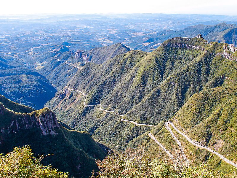
Serra do Rio do Rastro is a mountain range located in the southeast of the state of Santa Catarina, Southern Brazil. It is crossed by the road SC-390, with remarkable landscapes and deep cliffs.
This mountain range is situated between the municipalities of Lauro Müller and Bom Jardim da Serra, and its highest point is situated at 1,460 metres above sea level. In the highest areas of this place, the Atlantic Ocean, located about 100 km away, can be spotted on clear days. Frosts are common and snowfalls can occur in the highest areas.
Wikipedia https://en.wikipedia.org/wiki/Serra_do_Rio_do_Rastro
Address Brazil
Coordinates -28°21'8.806" N -49°32'33.662" E