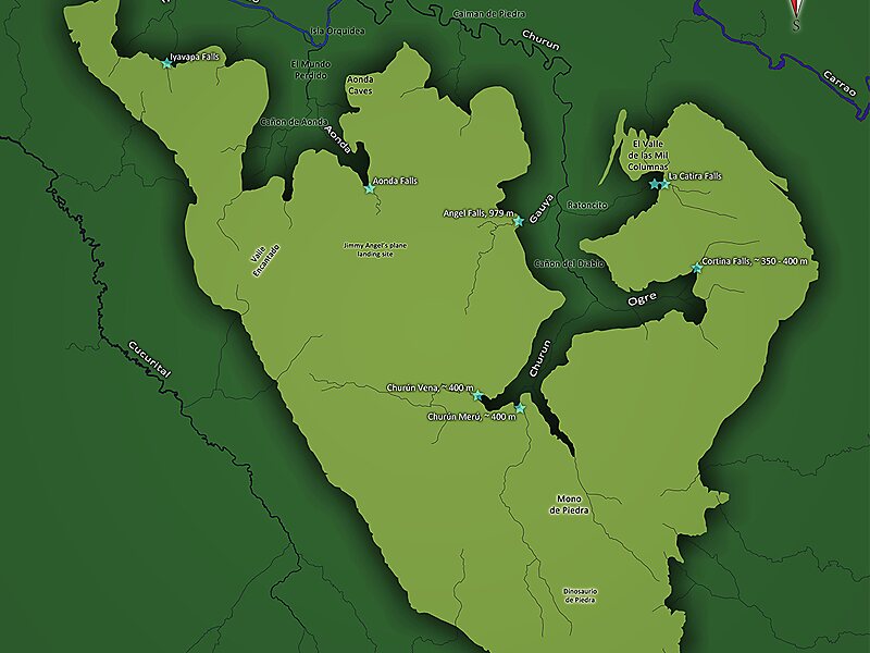
Auyán Tepui, also spelled Ayan, is a tepui in Bolívar state, Venezuela. It is the most visited and one of the largest tepuis in the Guiana Highlands, with a summit area of 666.9 km2 and an estimated slope area of 715 km2. The unevenly heart-shaped summit plateau of Auyán-tepui is heavily inclined, rising from around 1,600 metres in the northwest to a maximum of 2,450 m in the southeast. It is incised from the north by a vast valley, the Cañón del Diablo, formed by the Churún River.
Download Download See moreWikipedia https://en.wikipedia.org/wiki/Auyán-tepui
Address Venezuela
Coordinates 5°54'1.265" N -62°32'29.183" E