Binissafullet is a talayotic settlement which was occupied from the 10th century BC and had its height during the 4th and 3rd centuries BC. Medieval Islamic materials scattered around the site's surface suggest a later occupation during the Medieval period.
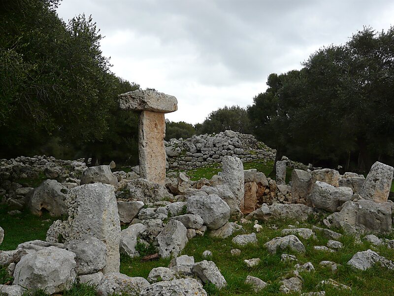
Binissafullet has several elements which are usually found in talayotic settlements: a talayot, a taula enclosure, a hypostyle hall, dwellings, silos...
In 1988 the site was deforested, whereas in 1990 its taula enclosure was excavated and restored. The taula, the main element inside the enclosure, was found on the ground during the excavations and later restored by replacing it in its upright position.
Wikipedia https://en.wikipedia.org/wiki/Binissafullet
Address Carretera de Binisafuller, 07710, Spain
Coordinates 39°50'44.967" N 4°14'5.581" E