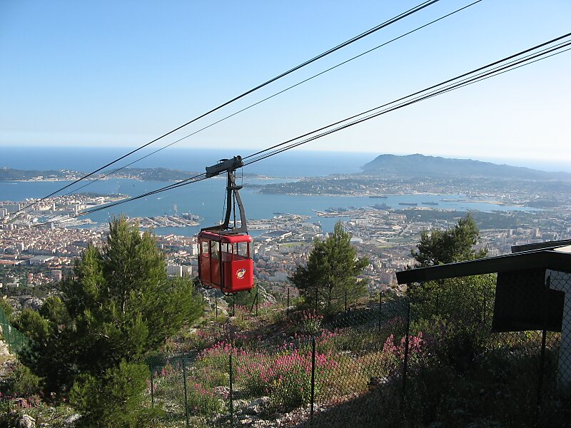
Mont Faron is a mountain overlooking the city and roadstead of Toulon, France. It is 584m high. At its peak is a memorial dedicated to the 1944 Allied landings in Provence, and to the liberation of Toulon.
The top can be reached either by a cable car from Toulon, or by a steep and narrow road which ascends from the west side and descends on the east side. The road is one of the most challenging stages of the annual Paris–Nice and Tour Méditerranéen bicycle races. From 1952 to 1970, there was a Mont Faron hill climb time trial race.Near the summit there is a zoo which covers an area of 1.5 hectares.
Wikipedia https://en.wikipedia.org/wiki/Mont_Faron
Official website http://www.montfaron.com/
More information at toulontourisme.com http://toulontourisme.com/en/things-to-do/toulon-nature-side/toulon-cable-car-family-outing-to-mont-faron/
Address (Unnamed Road), 83200, France
Coordinates 43°9'7.841" N 5°56'30.986" E

