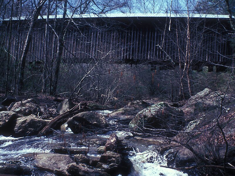
The Auchumpkee Creek Covered Bridge, near Thomaston, Georgia, was built in 1898. It was listed on the National Register of Historic Places in 1975.It is a Town lattice truss bridge. It has also been called the Hootenville Covered Bridge.It is located about 10 miles southeast of Thomaston, about 1 mile off U.S. 19 on Allen Rd.
"It spans Auchumpkee Creek in the Hootenville Militia District of Upson County, Georgia. The bridge is completely covered and extends 120 feet 9 inches in length resting on two native stone piers held together with cement."
Wikipedia https://en.wikipedia.org/wiki/Auchumpkee_Creek_Covered_Bridge
Official Website https://www.exploregeorgia.org/listing/273-auchumpkee-creek-covered-bridge
Address 440 Allen Rd, 31016, United States
Coordinates 32°45'20.367" N -84°13'47.577" E