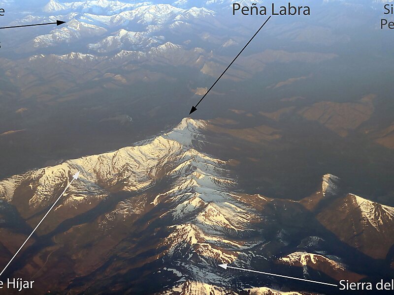
Peña Labra is a 2,018 metres high mountain located in the Sierra de Híjar range, a part of the Cantabrian Mountains System,. It is located on the boundary between the Province of Palencia and the Autonomous Community of Cantabria.
It is the westernmost peak of the Alto Campoo Massif.
The main trailhead for the mountain is at Puerto de Piedrasluengas, located at an elevation of 1,355 metres, 22 kilometres from Potes in Cantabria and 29 kilometres from Cervera de Pisuerga in Palencia, on the road CL-627.
Wikipedia https://en.wikipedia.org/wiki/Peña_Labra
Address 39557, Spain
Coordinates 43°2'44.019" N -4°25'55.702" E