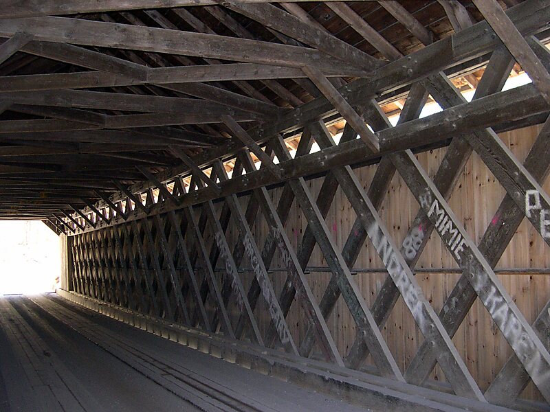
The Brown Covered Bridge is a wooden covered bridge in Shrewsbury, Vermont. Located in the northwestern part of the town, it carries Upper Cold River Road over the Cold River. It was closed to vehicular traffic in 2011 due to damage from Hurricane Irene and reopened as a National Historic Site on July 5, 2016. Built in 1880 by noted Vermont bridgewright Nichols M. Powers, it was designated a National Historic Landmark in 2014, cited as one of the finest and least-altered examples of a Town lattice truss covered bridge in the United States.
Download Download See moreWikipedia https://en.wikipedia.org/wiki/Brown_Covered_Bridge
Address 281 Upper Cold River Rd, 05738, United States
Coordinates 43°33'58.583" N -72°55'8.048" E