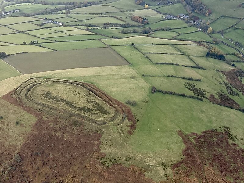
Caer Caradoc is an Iron Age hill fort and Scheduled Monument in the south-west of the English county of Shropshire, near the town of Clun. It overlooks the village of Chapel Lawn. It is located within an area of Open Access land and can be reached via a public footpath between the farms of Wax Hall to the west and Bryncambric to the east.This hill fort has the same name as another, Caer Caradoc near Church Stretton, also in Shropshire but 16 miles to the north-west.
Download Download See moreWikipedia https://en.wikipedia.org/wiki/Caer_Caradoc_(Chapel_Lawn)
Address SY7 0, United Kingdom
Coordinates 52°22'33.109" N -3°0'53.187" E