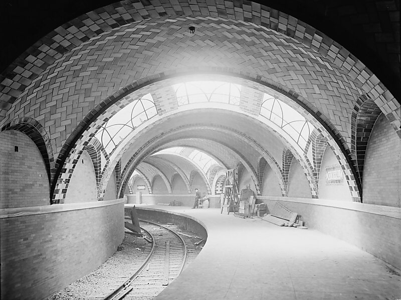
The City Hall station, also known as City Hall Loop, was a terminal station on the IRT Lexington Avenue Line of the New York City Subway. It was under City Hall Park next to New York City Hall in Civic Center, Manhattan.
The City Hall station was constructed for the Interborough Rapid Transit Company as the southern terminal of the city's first subway line, which was approved in 1900. Construction of the segment of the line that includes the City Hall station started on September 12 of the same year. The station opened on October 27, 1904, as one of the original 28 stations of the New York City Subway. As ridership grew, it was deemed infeasible to lengthen the original 257 ft platform to accommodate ten-car trains. The station was closed on December 31, 1945, because of its proximity to the Brooklyn Bridge station.
Wikipedia https://en.wikipedia.org/wiki/City_Hall_(IRT_Lexington_Avenue_Line)
Address 248 Broadway, Manhattan 10007, United States
Coordinates 40°42'45.499" N -74°0'24.051" E

