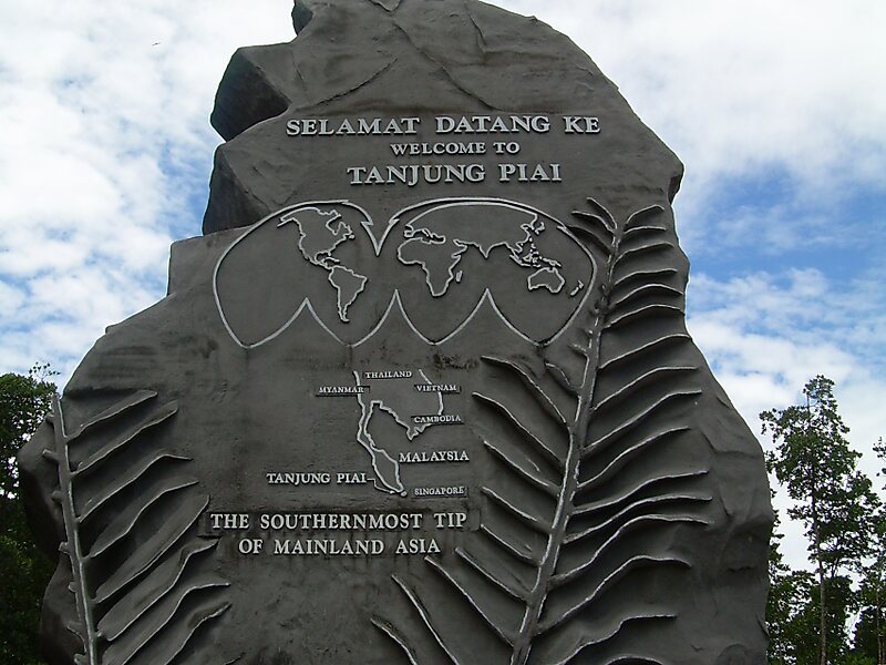
Tanjung Piai is a cape in Pontian District, Johor, Malaysia. It is the southernmost point of Peninsular Malaysia and thus the most southern point of mainland Eurasia. The skyline of Singapore is visible across the Johor Strait from the point. It features seafood restaurants, perched on wooden jetties that are surrounded by a rugged and rarefied coastline of unspoiled mangrove forests.
0.33 nautical miles south of the point, at the edge of the dries, is a 15-metre light tower which flashes once every 3 seconds and houses a radar transponder beacon which transmits the Morse letter "M".Tanjung Piai coastal mangrove is an internationally important Ramsar wetland site. Under the Ramsar Convention, the government and relevant stakeholders have an obligation to ensure the mangrove ecosystem and its values are maintained. Erosion at the site needs to be minimized to safeguard the ecological integrity of the mangrove ecosystem. The root causes of the erosion need to be eliminated or reduced.
Wikipedia https://en.wikipedia.org/wiki/Tanjung_Piai
Address (Unnamed Road), 82300, Malaysia
Coordinates 1°16'4.457" N 103°30'31.171" E