The Auckland Harbour Bridge is an eight-lane motorway bridge over the Waitematā Harbour in Auckland, New Zealand. It joins St Marys Bay on the Auckland city side with Northcote on the North Shore side. It is part of State Highway 1 and the Auckland Northern Motorway. The bridge is operated by the NZ Transport Agency. It is the second-longest road bridge in New Zealand, and the longest in the North Island.The original inner four lanes, opened in 1959, are of box truss construction. Two lanes that were added to each side in 1968–1969 are of orthotropic box structure construction and are cantilevered off the original piers. The bridge is 1,020 m long, with a main span of 243.8 metres, rising 43.27 metres above high water, allowing ships access to the deepwater wharf at the Chelsea Sugar Refinery, one of the few such wharves west of the bridge.
Download Download See more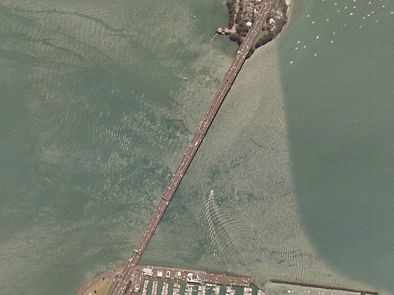
Wikipedia https://en.wikipedia.org/wiki/Auckland_Harbour_Bridge
Address Northern Motorway, New Zealand
Coordinates -36°49'52.558" N 174°44'42.852" E

