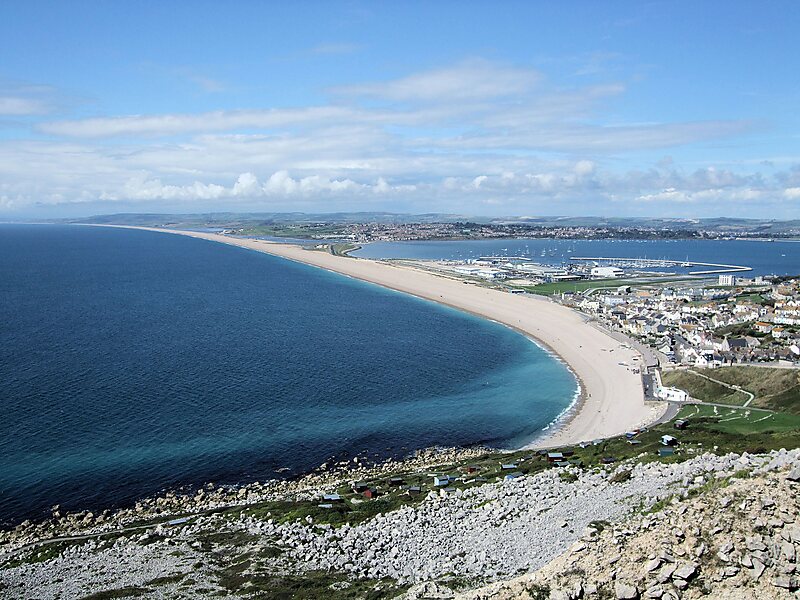
Chesil Beach in Dorset, England is one of three major shingle beach structures in Britain. Its name is derived from the Old English ceosel or cisel, meaning "gravel" or "shingle". It runs for a length of 29 kilometres from West Bay to the Isle of Portland and in places is up to 15 metres high and 200 metres wide. Behind the beach is the Fleet, a shallow tidal lagoon. Both are part of the Jurassic Coast and a UNESCO World Heritage Site, and together form an SSSI and Ramsar Site.
The beach is often identified as a tombolo, although research into the geomorphology of the area has revealed that it is in fact a barrier beach which has "rolled" landwards, joining the mainland with the Isle of Portland and giving the appearance of a tombolo.The beach curves sharply at the eastern end, near the village of Chiswell, and forms Chesil Cove against the cliffs of the Isle of Portland, and this protects the low-lying village from flooding.
Wikipedia https://en.wikipedia.org/wiki/Chesil_Beach
Coordinates 50°36'45.783" N -2°31'58.451" E