Fongafale is the largest of Funafuti's islets in Tuvalu. It is a long narrow sliver of land, 12 kilometres long and between 10 and 400 metres wide, with the South Pacific Ocean and reef on the east and the protected lagoon on the west. The north part is the Tengako peninsula, and Funafuti International Airport runs from northeast to southwest on the widest part of the island, with the village and administrative centre of Vaiaku on the lagoon side.On Fongafale, the Funafuti Kaupule is responsible for approval of the construction of houses or extensions to existing buildings on private land, and the Lands Management Committee is the responsible authority in relation to lands leased by government.In 1972, Funafuti was in the path of Cyclone Bebe. Cyclone Bebe knocked down 90% of the houses and trees on Fongafale. The storm surge created a wall of coral rubble along the ocean side of Fongafale and Funafala that was about 10 miles long, and about 10 feet to 20 feet thick at the bottom.
Download Download See more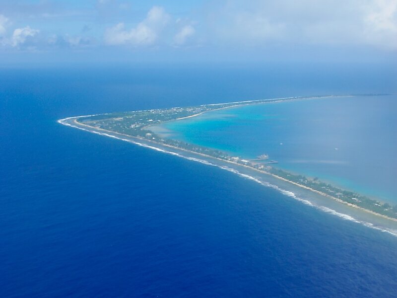
Wikipedia https://en.wikipedia.org/wiki/Fongafale
Coordinates -8°30'32.595" N 179°11'36.444" E

