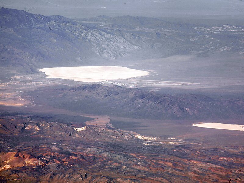
Groom Lake is a salt flat in Nevada used for runways of the Nellis Bombing Range Test Site airport. Part of the Area 51 USAF installation, it lies at an elevation of 4,409 ft and is approximately 3.7 miles from north to south and 3 miles from east to west at its widest point, and is approximately 11.3 miles in circumference. Located within the namesake Groom Lake Valley portion of the Tonopah Basin, the lake is 25 mi south of Rachel, Nevada.The nearest publicly accessible vantage point is Tikaboo Peak, 26 miles to the east. There were two closer vantage points, dubbed "Freedom Ridge" and "White Sides", but they were closed to public access in 1995 to prevent people from taking images of the installation.
Download Download See moreWikipedia https://en.wikipedia.org/wiki/Groom_Lake_(salt_flat)
Coordinates 37°16'25.082" N -115°47'58.898" E