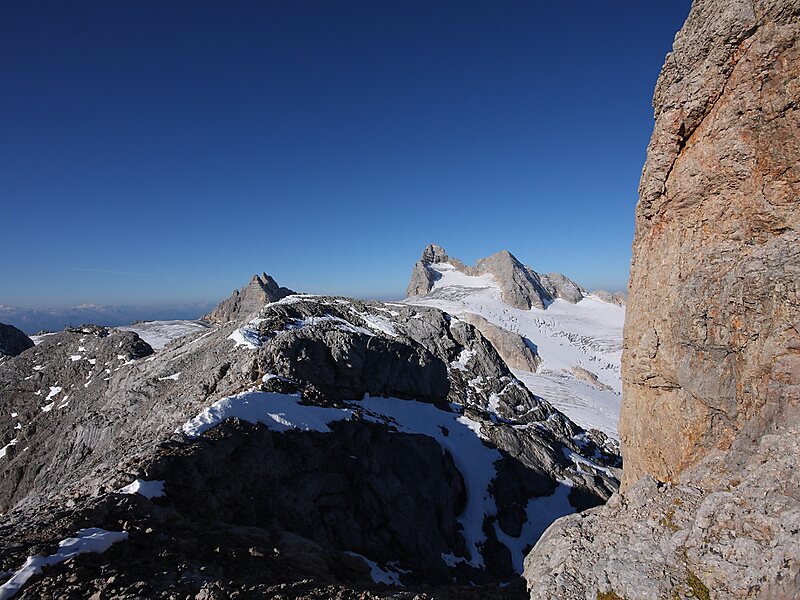
Hoher Dachstein is a strongly karstic mountain in central Austria and the second-highest mountain in the Northern Limestone Alps. It is situated at the border of Upper Austria and Styria, and is the highest point in each of those states. Parts of the massif also lie in the state of Salzburg, leading to the mountain being referred to as the Drei-Länder-Berg.
The Dachstein massif covers an area of around 600 square kilometres with dozens of peaks above 2,500 m, the highest of which are in the southern and southwestern areas. The main summit of the Hoher Dachstein is at an elevation of 2,995 metres. Seen from the north, the Dachstein massif is dominated by glaciers with rocky summits rising beyond them. By contrast, to the south, the mountain drops almost vertically to the valley floor.
Wikipedia https://en.wikipedia.org/wiki/Hoher_Dachstein
Address 4830, Austria
Coordinates 47°28'30.699" N 13°36'20.571" E
