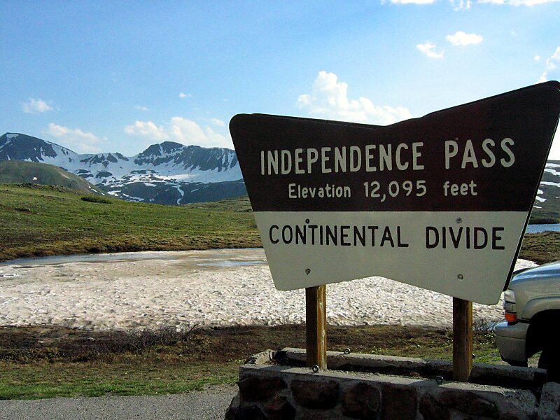
Independence Pass, originally known as Hunter Pass, is a high mountain pass in central Colorado, United States. It is at elevation 12,095 ft on the Continental Divide in the Sawatch Range of the Rocky Mountains. The pass is midway between Aspen and Twin Lakes, on the border between Pitkin and Lake counties.
State Highway 82 traverses it, and after Cottonwood Pass to the south, is the second highest elevation of a paved Colorado state highway on a through road. It is also the second-highest pass with an improved road in the state, the fourth-highest paved road in the state and the second highest paved crossing of the Continental Divide in the U.S. Because of the heavy snowfall at its elevation, it is closed in wintertime, isolating Aspen from direct access from the east during the ski season.
Wikipedia https://en.wikipedia.org/wiki/Independence_Pass_(Colorado)
Address State Highway 82, 81611, United States
Coordinates 39°6'26.657" N -106°35'42.532" E