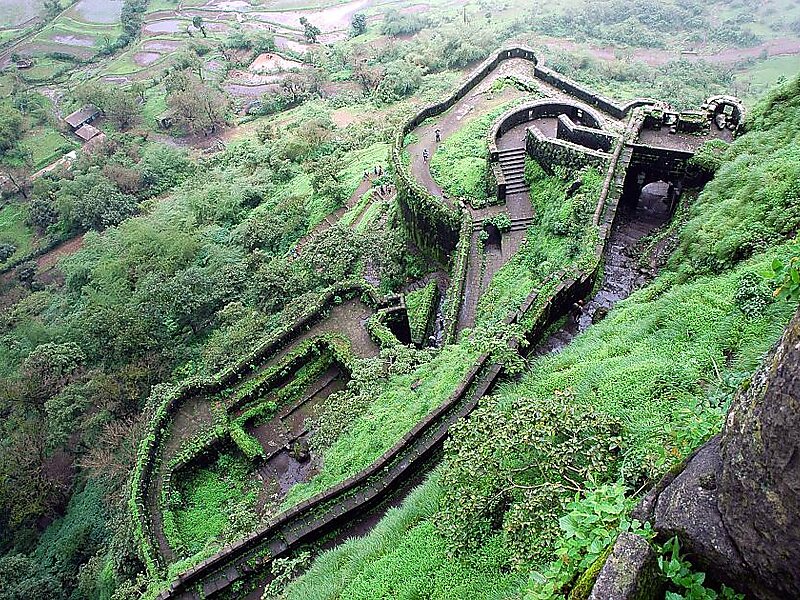
Lohagad is one of the many hill forts of Maharashtra state in India. Situated close to the hill station Lonavala and 52 km northwest of Pune, Lohagad rises to an elevation of 1,033 m above sea level. The fort is connected to the neighboring Visapur fort by a small range. The fort was under the Maratha empire for the majority of the time, with a short period of 5 years under the Mughal empire.
Download Download See moreWikipedia https://en.wikipedia.org/wiki/Lohagad
Address India
Coordinates 18°42'34.783" N 73°28'36.813" E