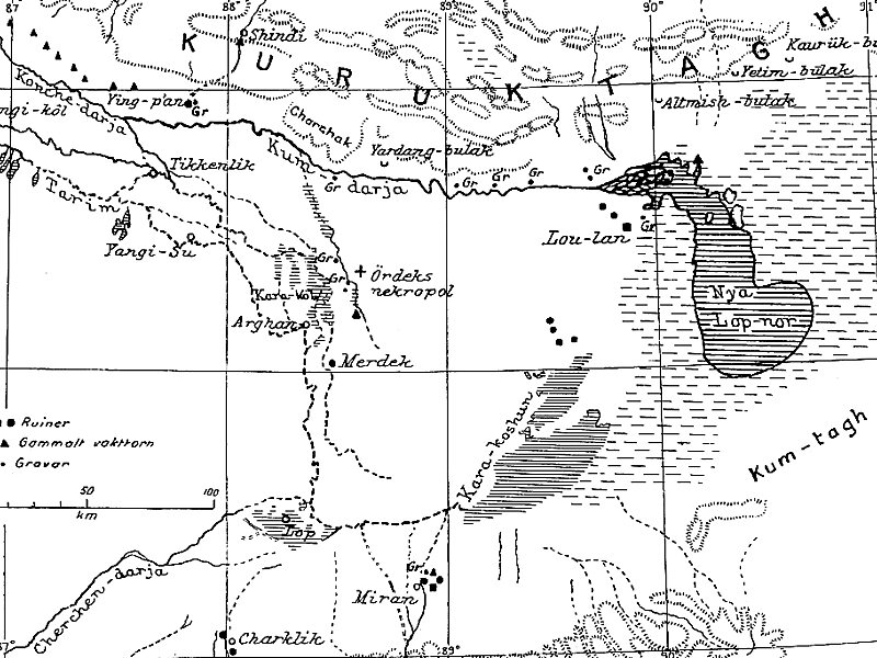
Lop Nur or Lop Nor is a former salt lake, now largely dried up, located in the eastern fringe of the Tarim Basin, between the Taklamakan and Kumtag deserts in the southeastern portion of the Xinjiang. Administratively, the lake is in Lop Nur town, also known as Luozhong of Ruoqiang County, which in its turn is part of the Bayingolin Mongol Autonomous Prefecture.
The lake system into which the Tarim River and Shule River empty is the last remnant of the historical post-glacial Tarim Lake, which once covered more than 10,000 square kilometres in the Tarim Basin. Lop Nur is hydrologically endorheic – it is landbound and there is no outlet. The lake measured 3,100 square kilometres in 1928, but has dried up due to construction of dams which blocked the flow of water feeding into the lake system, and only small seasonal lakes and marshes may form. The dried-up Lop Nur Basin is covered with a salt crust ranging from 30 to 100 centimetres in thickness.
Wikipedia https://en.wikipedia.org/wiki/Lop_Nur
Address China
Coordinates 40°42'29.571" N 90°55'28.524" E

