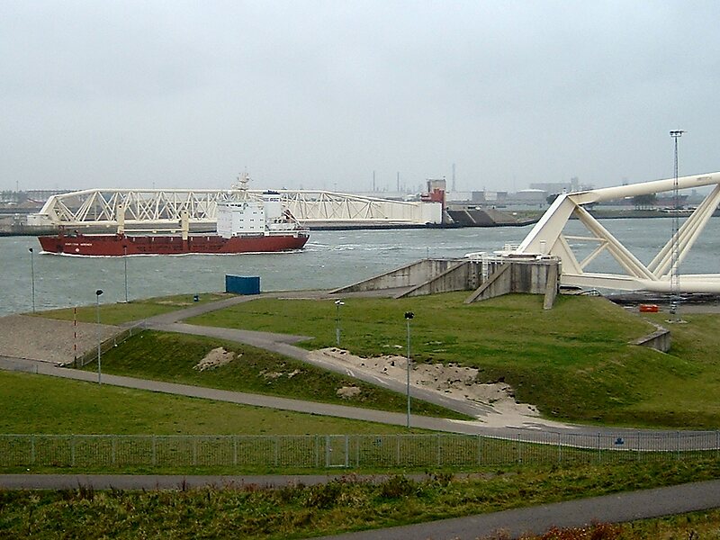
The Maeslantkering is a storm surge barrier on the Nieuwe Waterweg, in South Holland, Netherlands. It was constructed from 1991 to 1997. As part of the Delta Works the barrier responds to water level predictions calculated by a centralized computer system called BOS. It automatically closes when Rotterdam is threatened by floods.Maeslantkering has two 210-metre long barrier gates, with two 237-metre long steel trusses holding them. When closed, the barrier will protect the entire width of the Nieuwe Waterweg, the main waterway of Port of Rotterdam. It is one of the largest moving structures on Earth, rivalling the Green Bank Telescope in the United States and the Bagger 288 excavator in Germany.
Download Download See moreMon - Fri: 10 a.m. - 4 p.m.
Sat - Sun + holidays: 11 a.m. - 5 p.m.
Closed: 1 Jan, 25 and 31 Dec
Entrance:
Adults: € 2
Under 17: Free
Guided tour:
Adults: € 4.30
Children (4-12): € 2.30
Wikipedia https://en.wikipedia.org/wiki/Maeslantkering
Facebook https://www.facebook.com/hetkeringhuis.publiekscentrumwater
Instagram https://instagram.com/keringhuis
Email info@keringhuis.nl
Phone +31 174 511222
Address Maeslantkeringweg 139 3151 ZZ Hoek van Holland, Netherlands
Coordinates 51°57'17.342" N 4°9'47.695" E