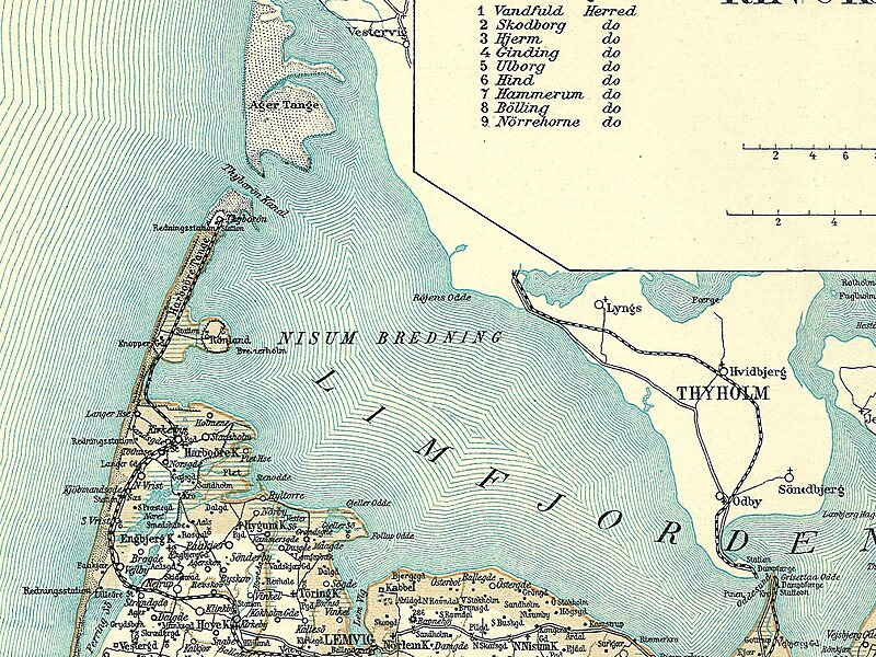
Nissum Bredning is the westernmost bredning in the Limfjord situated between Thyborøn Channel, through which the fjord is connected to the North Sea, and Oddesund with Oddesund Bridge. Its size is around 200 km2 and the depth is up to 6 meters. The length from east to west is about 24 km, and from south Gjeller Odde to the north Røjensø Odde is about 10 kilometer; from here it continues as Krik Vig to the north. To the west, at Thyborøn and Harboøre Tange, there are some sandbanks, Fjordgrund and Gåseholm. There is a navigable channel Sælhundeholm Løb, going south from the channel along Agger Tange, passing Rønland with the chemical factory Cheminova, where it turns east.
At the south end of Harboøre Tange is the town Harboøre, from here the coast turns to the east and a bit south. Partly through the little Hygum Nor, there are several outlets from Ferring Sø, Søndervese, and Nørrevese.
Wikipedia https://en.wikipedia.org/wiki/Nissum_Bredning
Address 7620, Denmark
Coordinates 56°38'12.196" N 8°21'15.789" E

