The Struve Geodetic Arc is a chain of survey triangulations stretching from Hammerfest in Norway to the Black Sea, through ten countries and over 2,820 km, which yielded the first accurate measurement of a meridian.The chain was established and used by the German-born Russian scientist Friedrich Georg Wilhelm von Struve in the years 1816 to 1855 to establish the exact size and shape of the earth. At that time, the chain passed merely through three countries: Norway, Sweden and the Russian Empire.
Download Download See more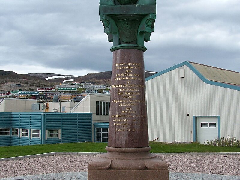
Wikipedia https://en.wikipedia.org/wiki/Struve_Geodetic_Arc
Official Website http://globus.tut.by/pucevichi/index.htm#struve_point
Address Belarus
Coordinates 53°36'6.47" N 25°46'24.659" E
