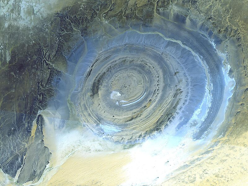
The Richat Structure, also called Guelb er Richât, is a prominent circular geological feature in the Sahara's Adrar Plateau, near Ouadane, west–central Mauritania, Northwest Africa. In the local dialect, Richat means feather and it also is known locally in Arabic as tagense. Tagense refers to the circular opening of the leather pouch used to draw water from local wells.It is an eroded geological dome, 40 kilometres in diameter, exposing sedimentary rock in layers which appear as concentric rings. Igneous rock is exposed inside and there are spectacular rhyolites and gabbros which have undergone hydrothermal alteration, and a central megabreccia. The structure is also the location of exceptional accumulations of Acheulean archaeological artifacts.
Download Download See moreWikipedia https://en.wikipedia.org/wiki/Richat_Structure
Address Mauritania
Coordinates 21°6'9.565" N -11°23'10.311" E