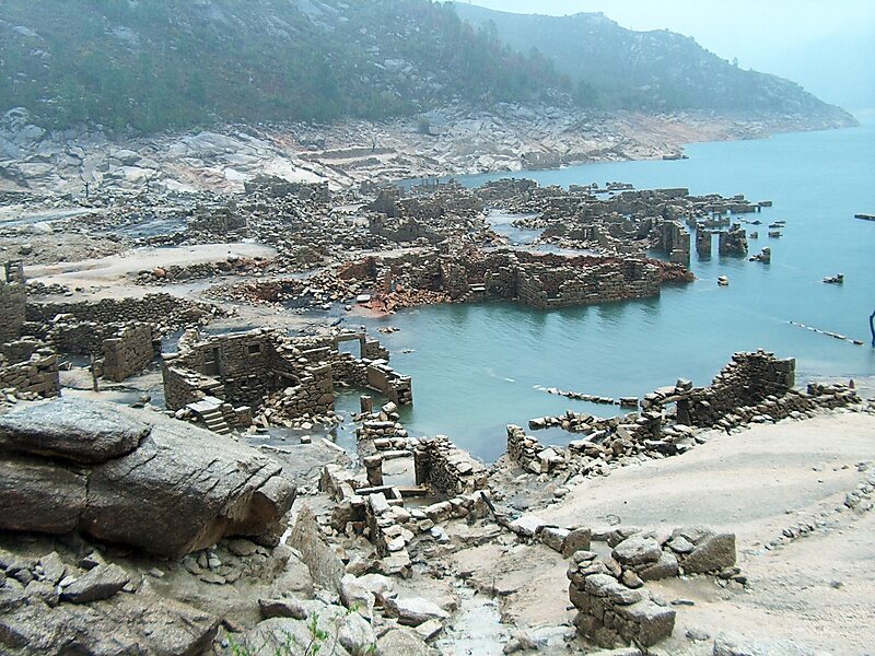
Vilarinho da Furna was a former-village, located in the civil parish of Campo de Gerês, in the municipality of Terras de Bouro, in the northern Portuguese district of Braga. Located on margins of River Homem and Ribeira do Eido, in 1972, it was intentionally submerged by the Portuguese State during the course of filling of a reservoir of the same name. Although still legally held by the former-villages, the lands are inundated, and only visible during the dry season, when it emerges, becoming a tourist attraction.
Download Download See moreWikipedia https://en.wikipedia.org/wiki/Vilarinho_da_Furna
Coordinates 41°46'49.76" N -8°11'48.574" E