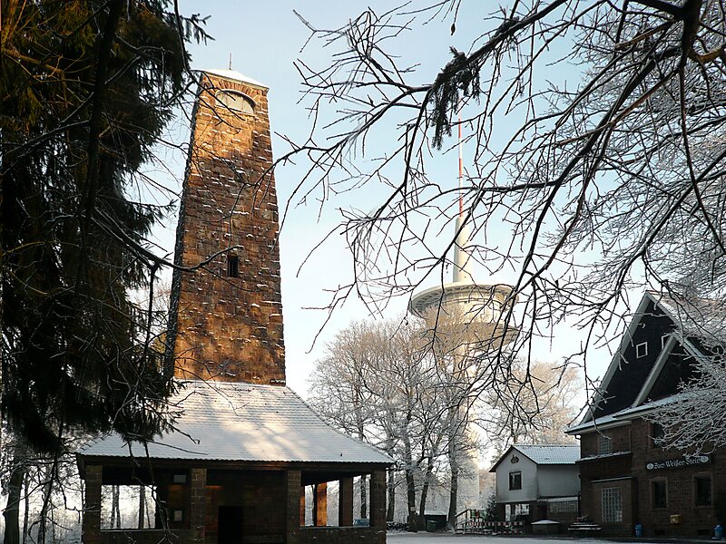
Weißer Stein is the name of a 548-metre high hill in the Odenwald, north of Heidelberg and east of Dossenheim.
On Weißer Stein is a 20 m tall lookout tower. It was built in 1906 by the members of the Odenwald club. In good weather other high mountains of the Odenwald can be seen, such as Melibokus, Katzenbuckel, Tromm and Neunkircher Höhe. Near the tower is the Höhengaststätte Weißer Stein tavern with a beer garden.
Nearby is the 108 m tall broadcast tower of the Deutsche Telekom AG and an additional antenna mast. The broadcast tower is a Type 11.
Wikipedia https://en.wikipedia.org/wiki/Weißer_Stein
Address 1 Weißer Stein, 69259, Germany
Coordinates 49°27'11.078" N 8°43'22.799" E